The City of San Antonio has many assets that make it a desirable place to live and a place that is estimated to capture a significant number of new residents and employees over the coming decades. These assets serve as the basis for future opportunities. However, changes in demographic trends, land supply, development patterns and other factors have generated challenges that the city must address to develop sustainably, to be economically competitive and to retain a high quality of life for our residents. The city’s assets, challenges and opportunities are summarized throughout this chapter and supplemented with plan element specific strengths and weaknesses in Section 3.
Background and Vision
Assets, issues and opportunities
Water Resources and Equity
Resilience
Assets and Opportunities
The underlying assets, opportunities and challenges that this plan must address are driven by the forecast for new growth for the city and region. San Antonio, with a total population of 1.44 million (2014 US Census), is the seventh largest city in the nation. The City of San Antonio surpassed Dallas in the early 2000s to become the second largest city in Texas. Both San Antonio and Bexar County have experienced strong population and employment growth over the past decade. These trends are expected to continue as an additional 1.1 million people and over half a million jobs and households are forecast by the Alamo Area Council of Governments for Bexar County between 2010 and 2040. This amount of growth would represent a 65% increase in the population in Bexar County, much of which has the potential to be within San Antonio city limits.
The forecasted amount of growth represents significant opportunity for our community. The city will have a range of demand for housing types from a growing diversity of residents. This growth will generate a variety of new jobs needing varying sites and buildings in which to locate. Aligning the land use plan for San Antonio to match market demand and consumer and employer preferences will allow the city to provide more housing choice, generate additional economic opportunity, and help address issues such as affordable housing, income/economic segregation and health goals and objectives.
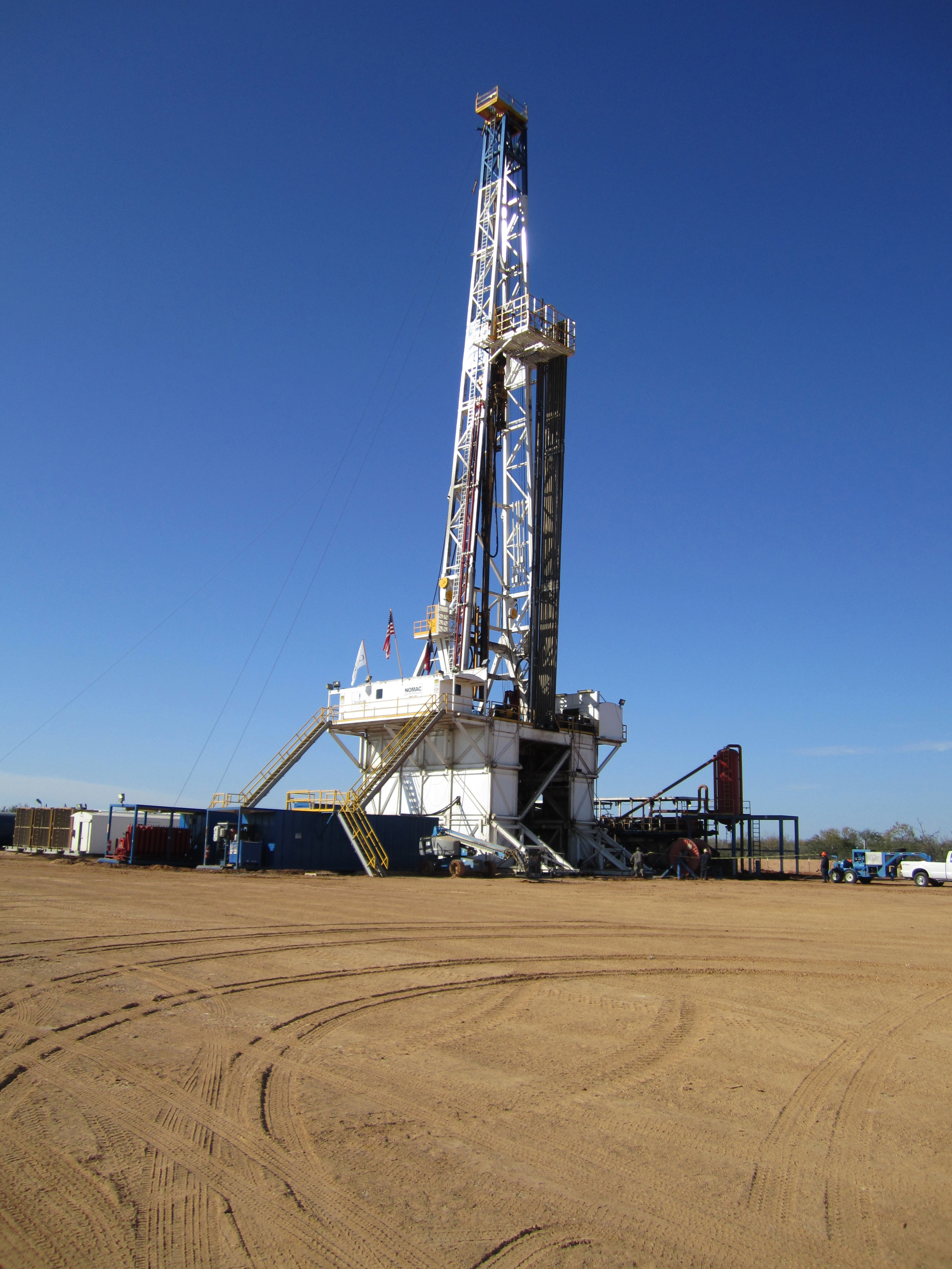
The Eagle Ford Shale formation has stimulated the economy and generated new development of jobs, housing, goods and services.
EMPLOYMENT AND ECONOMY
San Antonio is home to primary employment centers and economic engines in the greater San Antonio-New Braunfels Metropolitan Statistical Area. Our core economic assets are the major drivers for our four traditional industries (tourism/hospitality, healthcare, education, and military). We also have other major economic assets, both long standing and emerging, that provide us with a diversity of opportunities for future economic growth.
San Antonio is also an attractive place to do business. The business-friendly and low-tax environment in Texas appeals to many companies considering locating here. Also adding to the appeal are the city’s municipally-owned utilities (CPS Energy and San Antonio Water System), which provide affordable energy and water and the ability to innovate their approach to long-term service.
Over the past ten to fifteen years, San Antonio’s economy has grown steadily and is predicted to continue this course. This economic growth will drive demand for housing and hopefully improve opportunities for existing residents. With a polycentric economic geography and multiple large concentrations of employment throughout the city, living near work is easier for many residents.
Yet this polycentric employment pattern can pose problems such as establishing a coordinated approach to job growth and connecting residents to jobs through multiple modes of transportation. Continued growth in these centers of employment and housing will help keep travel distances and commute times lower for residents and provide potential opportunities for better multimodal connectivity.
San Antonio’s geographic location is also an asset to our economy and makes us an attractive place to live. Proximity to the Eagle Ford Shale formation and the fracking of natural gas is a major asset to our city. The primary active area for drilling is along I-37 between San Antonio and Corpus Christi has made San Antonio a major hub for business, services, goods and housing needed to support the drilling activities in the Eagle Ford. Additionally, our city’s location near major sea ports in Houston and Corpus Christi and major interstates is also significant. Connectivity to those ports via roadway and rail makes San Antonio a competitive logistics location facilitating national and international trade. San Antonio’s close proximity to Austin, also experiencing significant growth, provides an opportunity for a coordinated approach that may generate larger opportunities for growth in the Central Texas region.

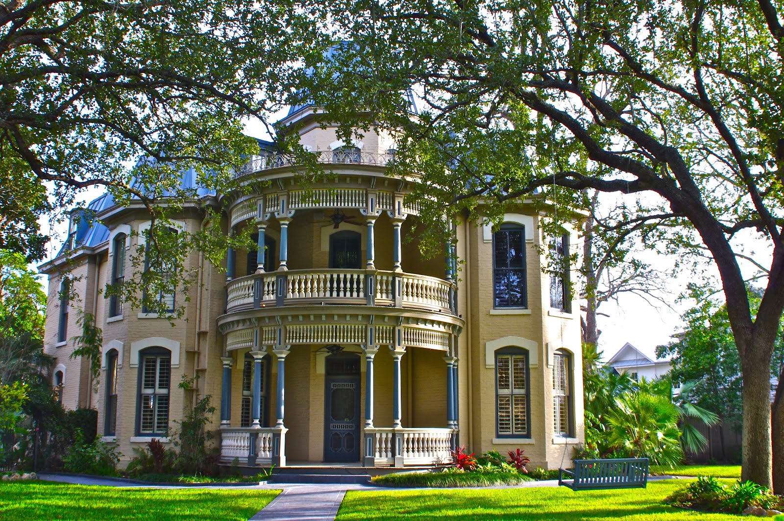
SeaWorld San Antonio and historic assets like the King William Historic Neighborhood are destinations for residents and visitors alike.
TOURISM
San Antonio is a major tourist destination in the U.S. and hosts more than 31 million visitors annually, 24.9 million of which come for leisure activities. Anchored by its unique history and culture, San Antonio is home to the Alamo, River Walk and other major attractions such as SeaWorld San Antonio, Six Flags Fiesta Texas, the Henry B. Gonzalez Convention Center, the Museum and Mission reaches on the River Walk, the Tobin Center for the Performing Arts and the Pearl Brewery development. Our San Antonio Missions are a National Historical Park and were recently named a World Heritage Site by the United Nations Education, Scientific and Cultural Organization (UNESCO).
QUALITY OF LIFE
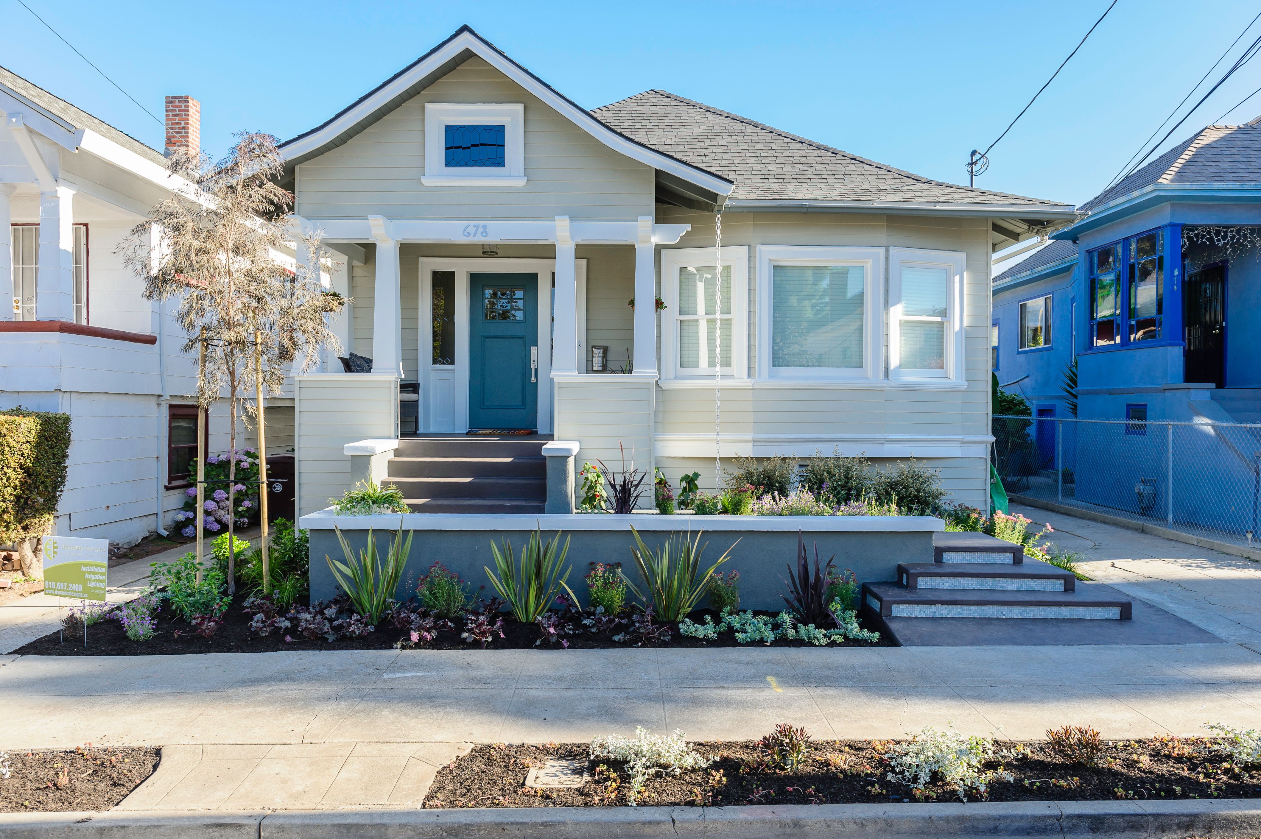
Another significant asset to our community is our high quality of life. Our below-national-average cost of living and home prices and our strong economic growth, relatively short average commute times make our city appealing to new residents. In addition, San Antonio's strong cultural heritage gives us a unique sense of place.
Our historic neighborhoods are another example of how our heritage impacts housing and neighborhoods. The demographic makeup of the San Antonio's 27 historic districts is largely reflective of the city as a whole. The historic districts are some of the most desirable neighborhoods in the city. A study commissioned by the city’s Office of Historic Preservation in early 2015 found that the property values in the historic districts have increased over the past 15 years more than the city as a whole. The historic districts have many of the characteristics of neighborhood types that are in demand nationally, including walkability (all the historic districts have a higher Walk Score than the citywide average), a greater mixture of uses and even shorter commute times to work.
DEVELOPMENT OPPORTUNITIES
Our community has remarkable opportunities for infill development in the urban core. The Comprehensive Plan Initial Studies found that there are a large number of vacant and underutilized parcels within the inner core of the city (inside Loop 410) that are zoned commercial and industrial. Allowing for these commercial and industrial-zoned areas to redevelop with a wider mix of uses and introducing housing can help revitalize these areas and improve the surrounding existing neighborhoods.
GROWING MOMENTUM
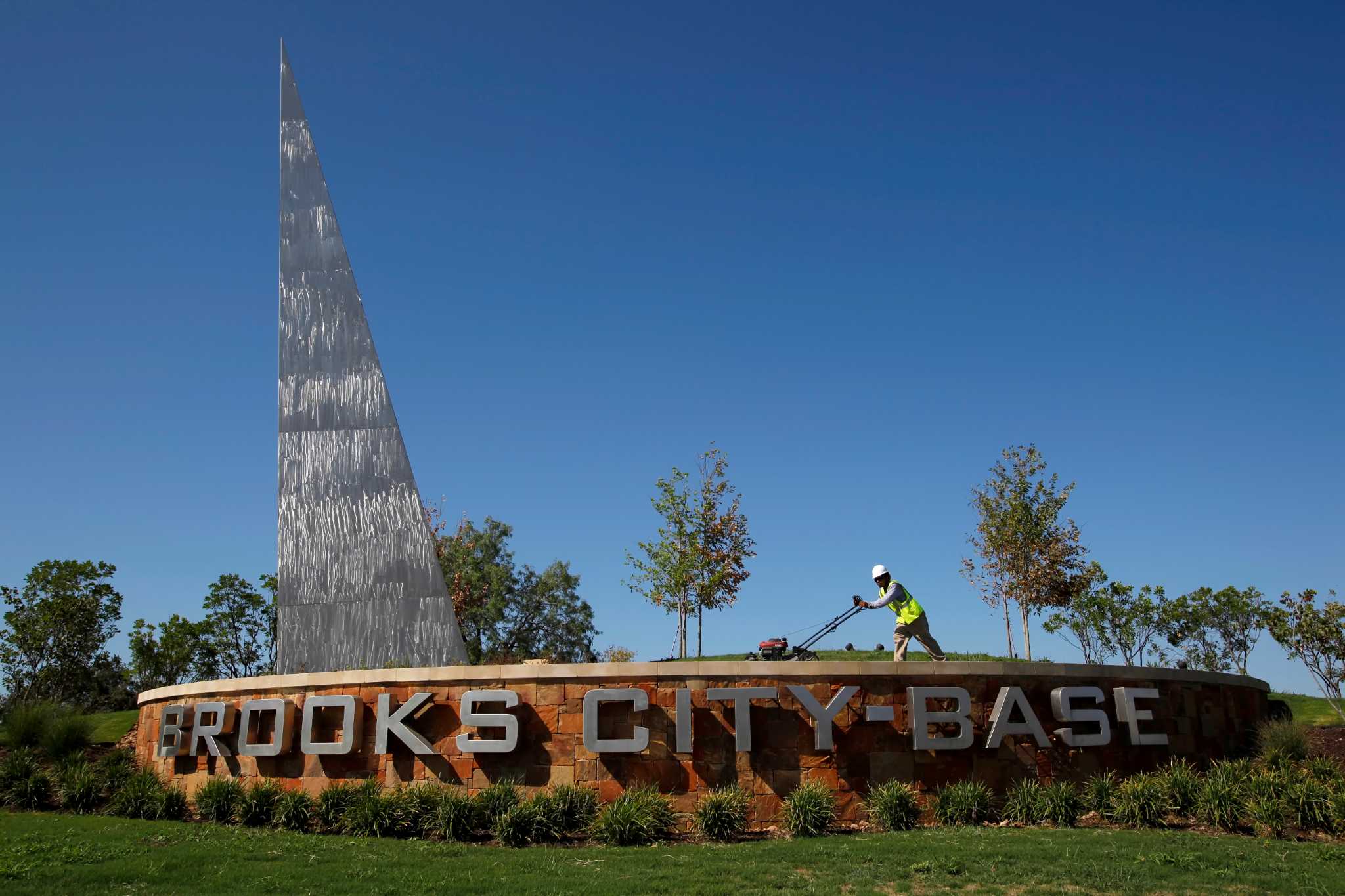
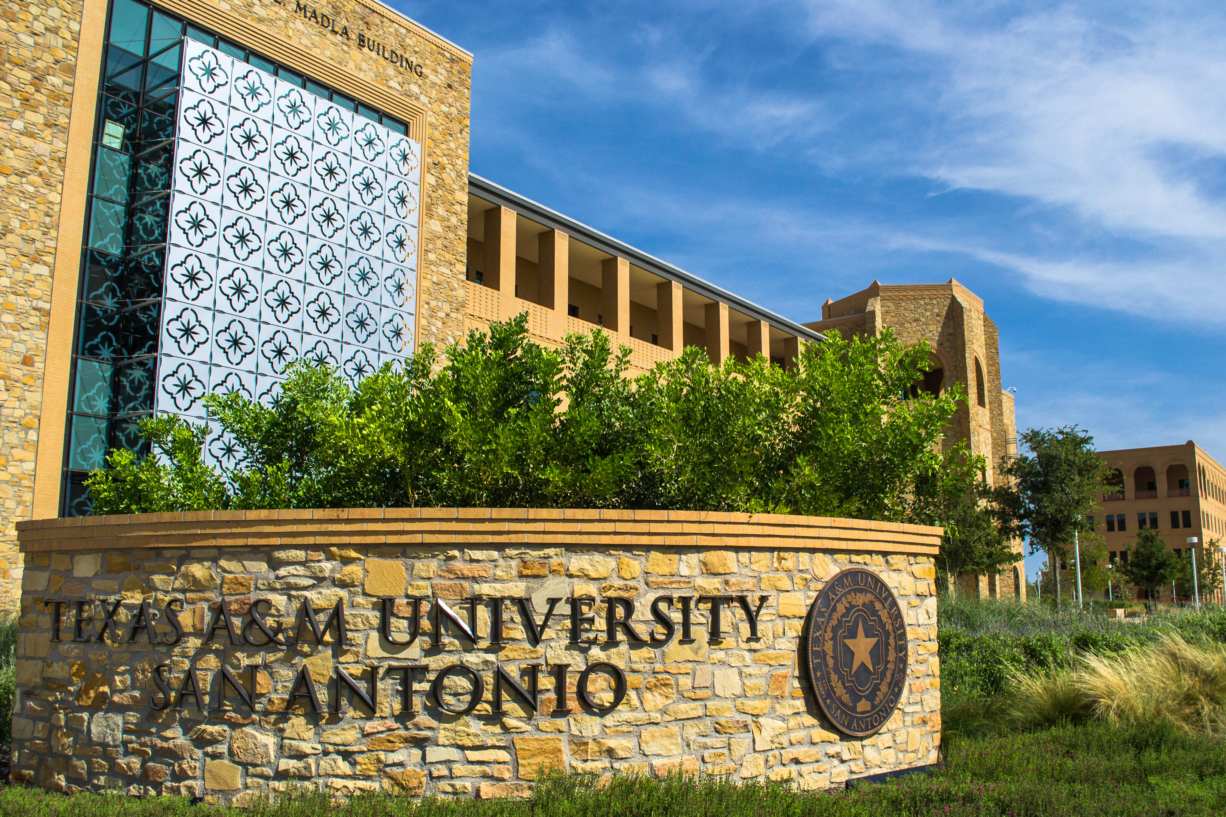
Our city has a number of large, transformational development projects—important sites that have the potential to change the prevailing direction of growth within our city. Four of these transformational development sites include Hemisfair, Brooks City Base, Port San Antonio and the Texas A&M University-San Antonio campus and associated development. The future development, or redevelopment, of these sites has the potential to catalyze development in portions of the city where recent growth has been relatively limited. More significantly, these sites are located in areas where an ample supply of developable land exists. The large size, limited number of owners, and public and political backing for these sites allows for the opportunity to create model development projects that can serve as a guide for future growth.
The recent economic upturn has resulted in significant investment in existing and new housing throughout San Antonio, as well as redevelopment or expansion of several transformational development sites.
Water Resources and Equity
Challenges
Despite our numerous assets, San Antonio does lack some key features and faces challenges that impact the future growth and health of our community.
UNCHECKED EXPANSION
Historically, San Antonio has had no major physical or political constraints to outward expansion. However, this is no longer the reality for the city. The boundary in the north and northeastern parts of the city have effectively reached the edge of Bexar County and the boundaries of multiple jurisdictions on the north including Boerne, Bulverde, Converse, Live Oak, Schertz, Universal City and others. The western edge of the city has begun to enter Medina County. This continued outward expansion has led to the perception of disinvestment in the urban core.
Changes to annexation law in 1999 made annexation more onerous for the city. As a result, San Antonio greatly curtailed its annexation efforts from 2000 to 2012. In the absence of annexation, a large amount of development occurred in the unincorporated portion of Bexar County, where the County has limited oversight. This has led to an inability to adopt zoning, perform residential building inspections, and raise any revenue to offset the new development costs to the County. Any development within the city’s extraterritorial jurisdiction (ETJ) is subject to some of the city’s development standards, but no mechanisms exist for enforcement once subdivision plats are approved.
DEVELOPMENT CAPACITY
San Antonio’s developable land capacity is constrained by physical and environmental barriers such as the 100-year floodplain, the Edwards Aquifer Recharge zone, steep slopes and environmentally critical habitats. It is estimated that these barriers create an estimated 27% reduction in development capacity. The northern portion of our city and Bexar County are particularly impacted by these barriers. For example, development potential in certain areas of San Antonio was met with concerns over potential impact of the Edwards Aquifer Recharge zone. In other areas, steep topography makes the provision of sewer service costly and challenging.
Moving forward, our community must work towards a more coordinated approach for identifying areas of development and coordinating the provision of utilities.
Moving forward, our community must work towards a more coordinated approach for identifying areas of development and coordinating the provision of utilities.
COMPETITION AND TRENDS
Over the past decade, San Antonio has been capturing a decreasing share of single-family home development within the Metropolitan Statistical Area (MSA) and now captures less than half of such new development. Developers have begun working in unincorporated parts of Bexar County for reasons including favorable public financing structures provided by the County, leading to a large amount of development outside the city’s boundaries and control. Single-family home buyers over the past decade have transitioned to the suburbs where lower homes prices and new infrastructure have allowed for easy access in and out of the city’s periphery.
However, market trends and land capacity analysis indicate that these recent growth patterns are changing. The north and northwestern portions of the county that saw so much recent growth are nearing build-out due to the lack of available land, topographic constraints, traffic congestion and corresponding challenges for utility service. A shift to the west, and to some degree to the south, is expected to occur. The city’s ability to create policies and infrastructure (utilities, schools, services, etc.) may provide additional shifts either to locations within the city limits or expansion into other counties.
AUTO-ORIENTED CITY FORM
The prevalence of highways and single-family neighborhoods in San Antonio created an auto-centric city form. A car is needed for most daily trips and the existing highway system is a significant barrier for non-auto travel modes. While our topography is generally flat, and we have a strong street grid system in older neighborhoods, our outward growth has been precipitated by a highway development pattern. Given the road network and limited multimodal access, subdivision development of this nature is often more isolated than neighborhood-focused development types that incorporate multiple options for travel.
Older subdivisions often lack basic pedestrian amenities, but have more road connections between the interior system and the main arterials. Newer subdivisions have very poor internal connectivity, often with many cul-de-sacs and a limited number of intersections. External connectivity is also very poor due to numerous new subdivisions relying heavily on the same arterial and collector roadways for basic travel outside the subdivisions to downtown, activity centers and other subdivisions.
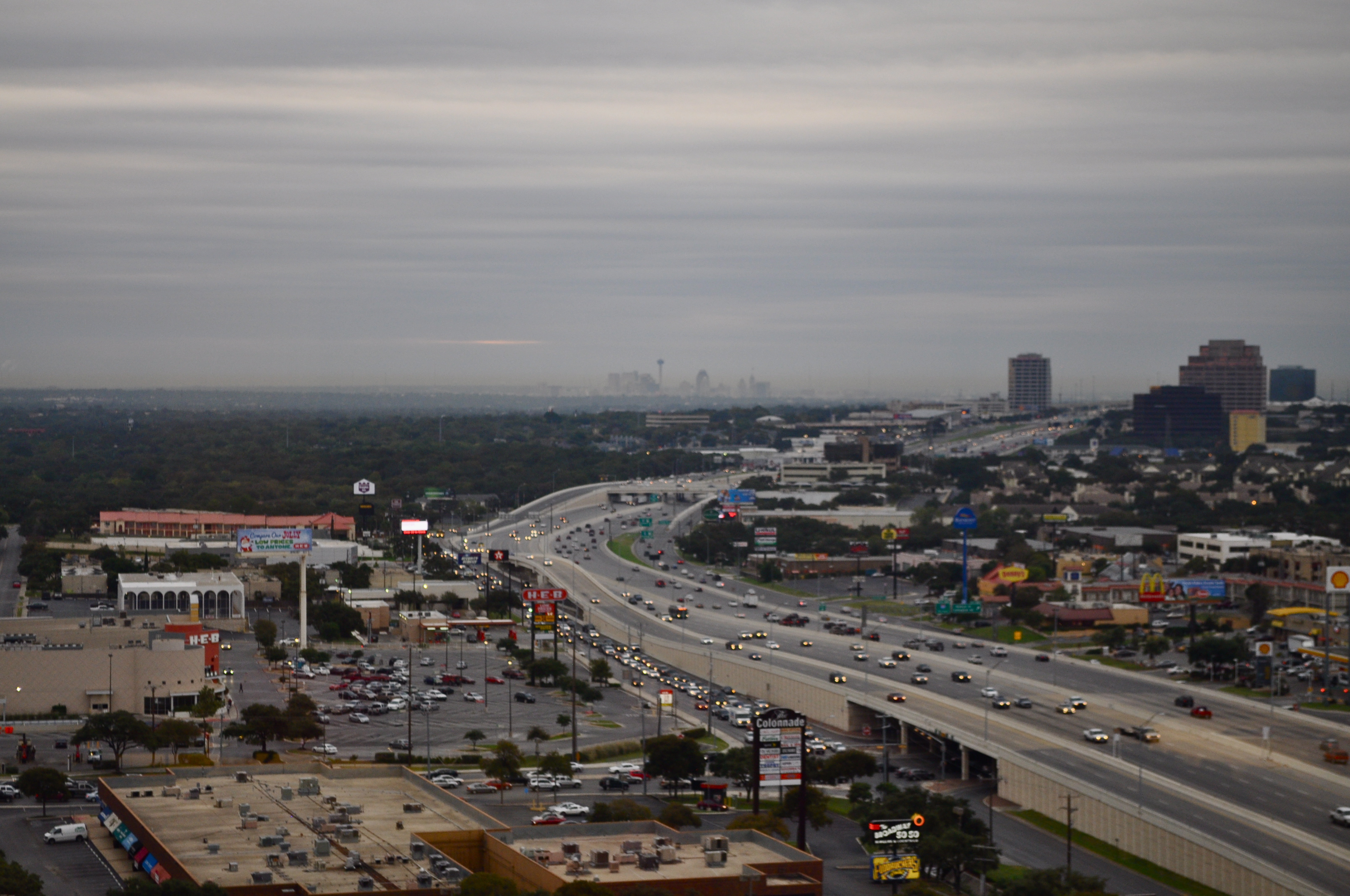
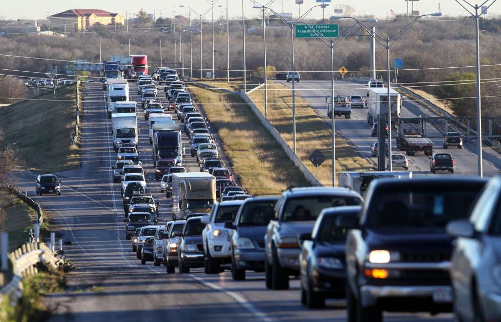
CONGESTION
Projected population growth and an increase in vehicle miles travelled (VMT) will lead to congestion throughout our city, especially on the far west side, downtown and the far north side. To manage this congestion many of the improvements included in regional infrastructure plans focus on the region's interstate highways. Yet as interstates become continually congested, stress will be placed on our streets, specifically major and minor arterials, as people look for alternate routes. For example, the north side of the city is expected to be heavily congested by 2040, with all major roads on the north and west sides of the city outside of Loop 410 over capacity with the exception of Wurzbach Parkway. The south side will experience significant congestion as well, with most major north-south roads operating at a failing level of service. The inner east and southwest sides are the only areas of the city that would still have available capacity (20% or greater) on their road network.
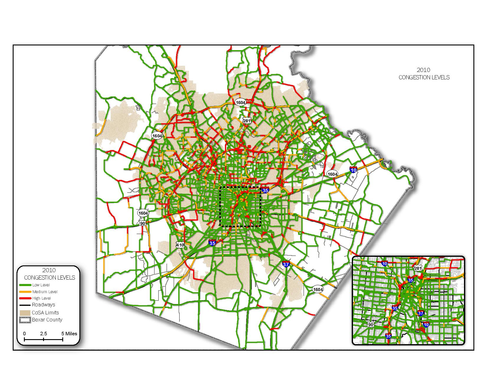
2010 Congestion Levels
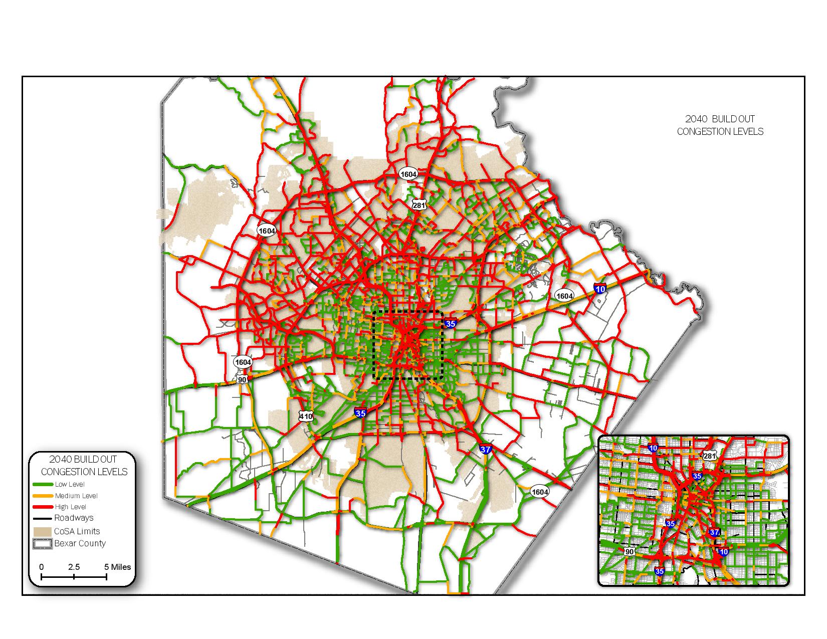
2040 Congestion Levels
Water Resources and Equity
MOBILITY AND ACCESS
Equitable access to a well-developed multimodal network and a connected city are critical aspects of our future growth. While walkable neighborhoods have been a goal in urban areas across the U.S. for years, San Antonio did not fully take on this planning initiative until the SA Tomorrow effort began. The goal of a walkable neighborhood is to provide residents safe and convenient access by walking, bicycling, or transit increasing connectivity to many of the places and services they use daily. In short, it's a neighborhood where residents can have a high quality of life without needing to rely on a personal vehicle for all trips.
San Antonio’s low walk score of 34 (on a scale of 100) is a clear sign of our car-dependent community. Walk scores are based on measures of pedestrian friendliness including population density, block length and intersection density and points are awarded based on a location's proximity to a variety of amenities in different categories. A score of 90-100 would indicate a “Walker’s Paradise.” Our community’s relative low number of bike lanes and insufficient amount of public transportation options are additional barriers we must address when working towards walkable and accessible neighborhoods.
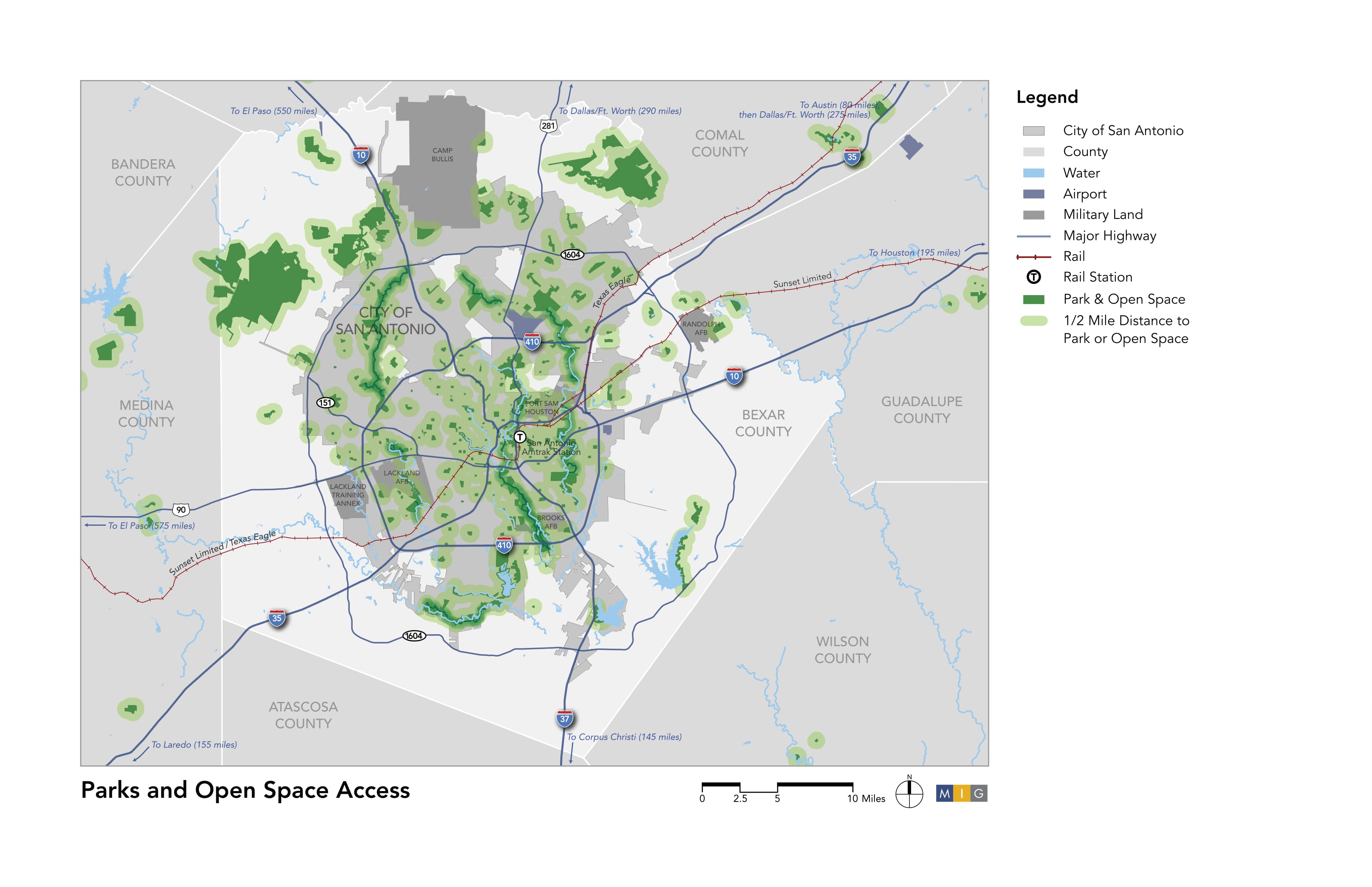
PARKS AND OPEN SPACE ACCESS
Water Resources and Equity
While walkability and connectivity of each neighborhood is important, our city also needs to address larger scale issues of green space integration. We need to support residential development within 1/2 mile of parks and other public recreation facilities, as well as find ways to better integrate and connect waterways, drainage ways and the buffer zones around military installations.

SOCIAL EQUITY AND AFFORDABLE HOUSING
Our city has among the highest levels of income segregation in the country. Often accompanied by clear geographic concentrations of poverty, economic segregation has numerous deleterious effects on the less fortunate members of our community. Lower-income individuals typically have reduced rates of economic mobility and often live in areas that struggle to attract jobs and residential amenities. In addition, these families tend to live in areas with lesser educational opportunities and their children often struggle in school.
Economically segregated groups in the San Antonio area may also face challenges achieving and maintaining healthy lifestyles. Generally speaking, racial and ethnic minorities and those with lower educational and income levels have the poorest health outcomes. This is attributed to difficulty in accessing healthcare, healthy food options and recreational opportunities. As of 2014, 28% of adults and 12% of children were uninsured in Bexar County and it is estimated that almost 20% delayed medical care due to unaffordable costs. In addition, healthcare resources are not equally accessible in all parts of our city-access by non-automobile modes is often difficult or impossible.
A higher proportion of San Antonio’s low-income residents (13%) live at least one mile from a grocery store, compared to 12% in Texas and 7% nationwide. Finally, several areas, particularly in the west and southwest, offer significantly fewer acres of parks facilities per 1,000 residents than other areas of our city. Our community must work to minimize economic segregation, provide equal opportunities and access to resources and foster programs that empower low-income residents.
Economic segregation is also a factor contributing to our city’s affordable housing gap. The city’s Comprehensive Needs Housing Assessment and Strategic Housing Plan (2013) concludes that San Antonio’s housing market is increasingly unaffordable; fewer than 50% of homes on the market are priced attainably for families with median incomes. Areas with higher concentrations of affordable housing are primarily located in the near-east and near-west side neighborhoods around downtown and in the southern part of the city. Housing affordability issues are further compounded for many of our residents when transportation costs are included. Less than 30% of households in the San Antonio-New Braunfels Metropolitan Statistical Area (MSA) live in areas that are considered affordable when total housing plus transportation costs are considered.
DECLINING NEIGHBORHOODS
A cycle of disinvestment has perpetuated the problems witnessed in our community’s declining neighborhoods today and contributed to under-performing schools and depressed infrastructure. The southern and central portions of San Antonio are especially at risk for high income disparity. San Antonio’s rapid growth to the north has diverted much of the city’s capital investment and other resources away from core neighborhoods inside Loop 410. These areas generally have an auto-oriented urban form with low walkability and few destinations easily accessed without a vehicle. This creates an environment that limits many residents’ mobility and access to crucial important needs such as education, healthcare, recreation and job opportunities.
ENVIRONMENTAL SUSTAINABILITY
Population growth and business expansion will increasingly strain our city’s environmental health. Air quality, water supply, drainage and mitigating impacts from climate change and extreme weather are all challenges we face. Our air quality has been worsening for many years. San Antonio must lead the region in striving to maintain compliance with state and federal requirements that help ensure the safety and health of our residents, especially with an additional 500,000 cars on our roads by 2040.
Water supply, water quality and drainage are critical issues. The San Antonio Water System (SAWS) has made great strides ensuring a diversified water supply and helping our city lead the nation in water conservation and recycling programs. However, the city and all its residents and businesses must collaboratively continue and strengthen our efforts. Drainage and water quality are also ongoing challenges that may be intensified by increasing instances and severity of extreme weather events. Flooding is a historic problem in the area and, in addition to safety and property damage implications, it can have serious negative effects on the health of our rivers and streams.